Service Region: Baltic Sea
Areas of Benefits:The BALFI service covers the following areas of benefits targeted by the Copernicus Marine Environment Monitoring Service (CMEMS)
| Marine and Coastal Environment | Maritime Safety |
| Tourism activities | Winter navigation |
| Near-shore construction: | Search and rescue |
| Other: ice roads to islands | Other: recreational activities on landfast ice |
Description of the Service
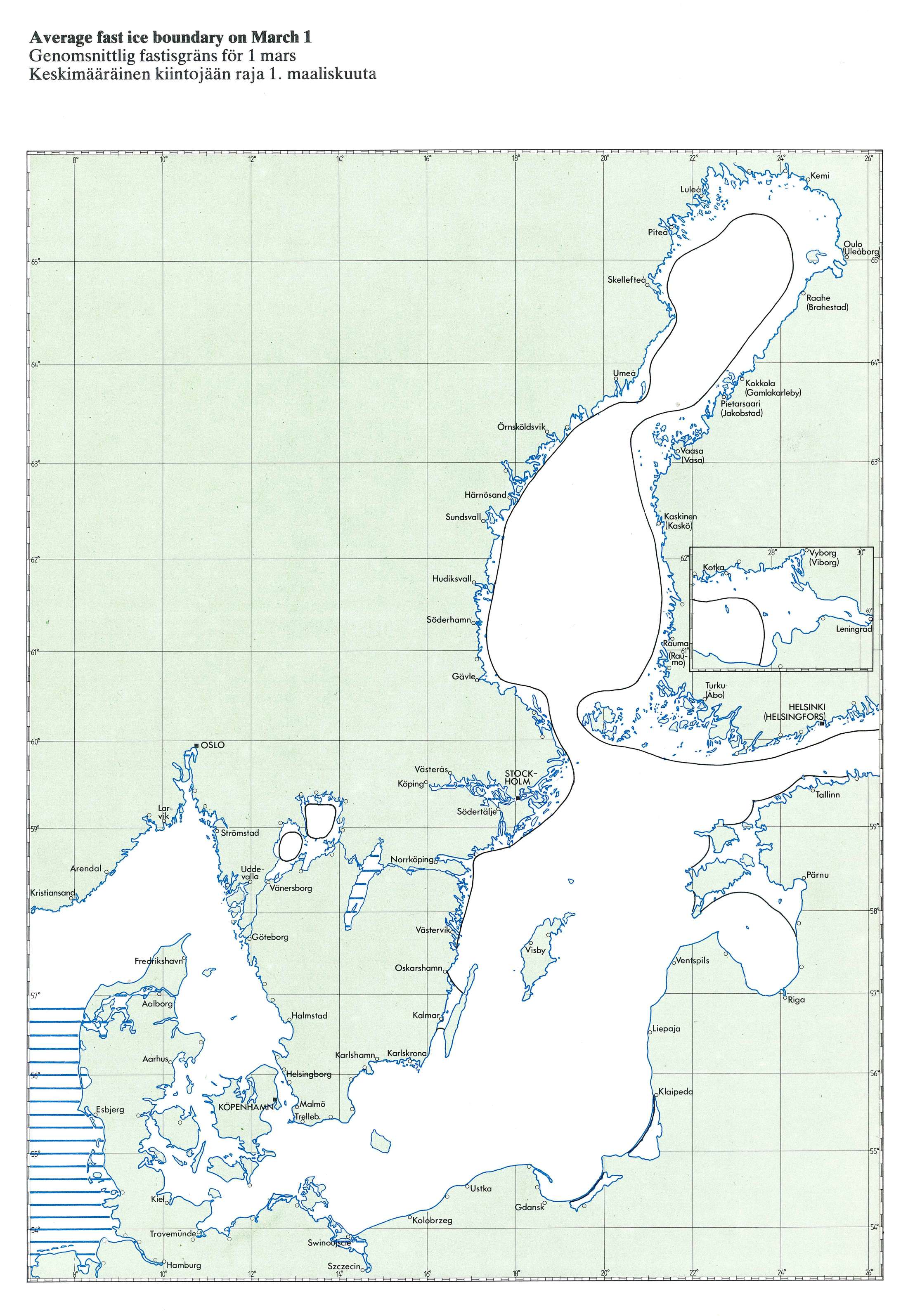
Background - Baltic Sea landfast ice
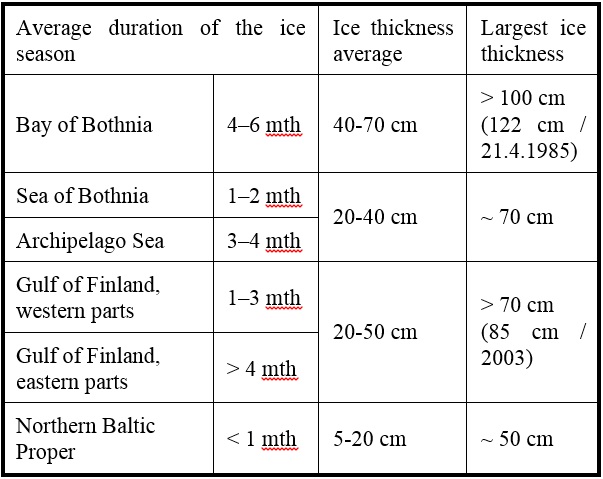
The Baltic Sea is partly covered by ice in every winter and spring; from Nov/Dec to May. Every winter landfast ice exists at least along the coasts of the Bay of Bothnia (coastal states are Finland and Sweden) and the Gulfs of Finland and Riga (Finland, Estonia, Latvia and Russia), and in the Finnish Archipelago Sea. During average winter landfast ice covers also the coast of the Sea of Bothnia (Finland and Sweden). In severe winter it is also present in the Southern Baltic Sea. Along the Finnish and Swedish coast there is a landfast ice cover from one month up to a half a year.
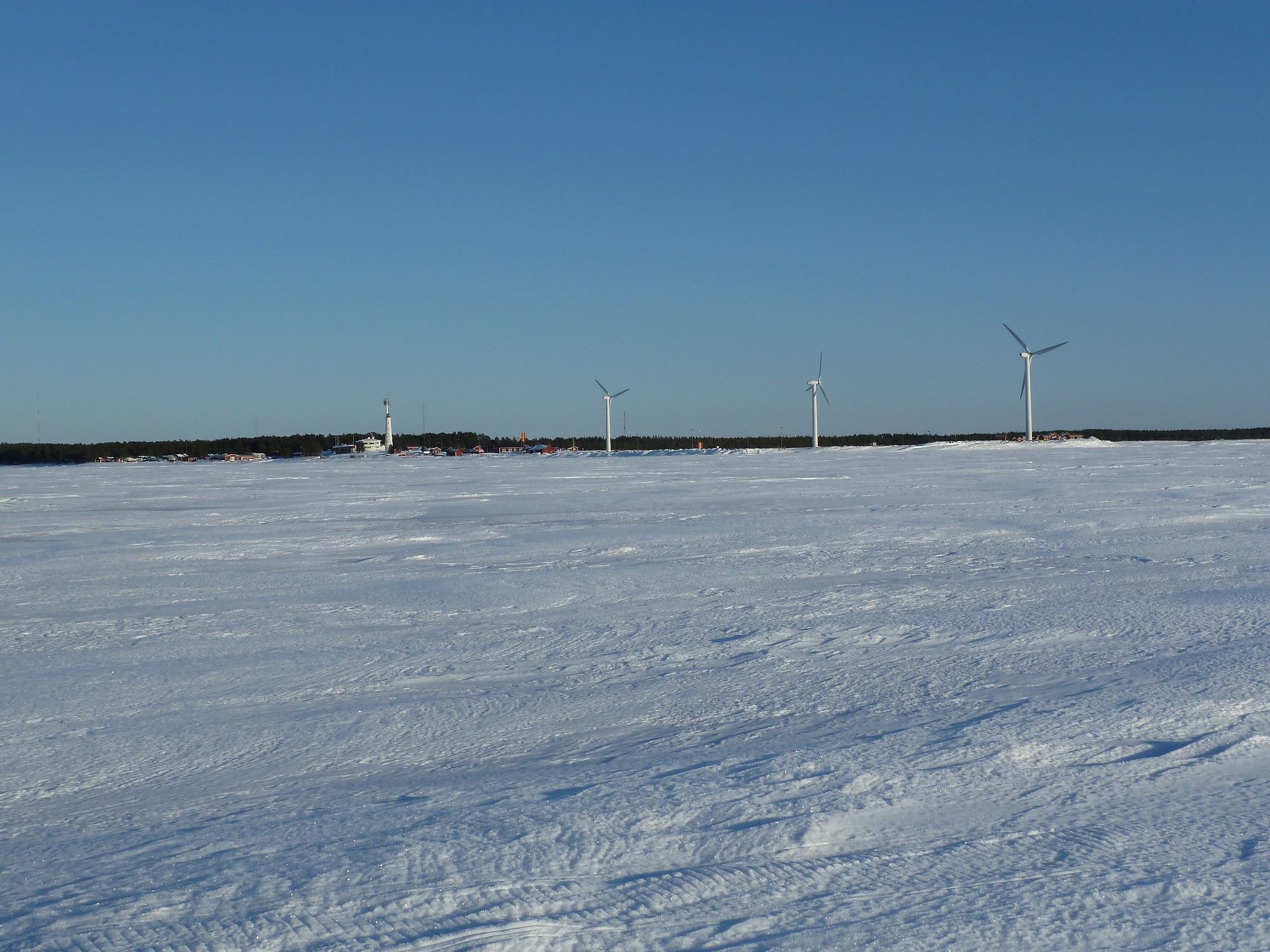
The Baltic Sea landfast ice zone may extend from a few hundred meters to several tens of kilometres from the coast and is place for many recreational activities such as skiing, skating, and ice fishing. Over thick landfast ice roads can be established between main land and populated islands (e.g. Hailuoto in the Bay of Bothnia) to speed up transportation compared to the use of ferries. Landfast ice also allows transport of material to or from islands without piers for large ships or usage of slow and costly barges.
For all these activities extent and thickness of landfast ice are very important. Other important parameter includes snow thickness on sea ice and degree of ice deformation (e.g. location of ice ridges). In deformed ice e.g. recreational activities may not be possible. In addition, for the safety of the activities on landfast ice location of ship tracks in the sea ice need to be known.
Before the BALFI service the Baltic Sea landfast ice extent and thickness information in fine scale (~ 1 km) was not directly available from any product or source.
BALFI - Service for the Baltic Sea Land Fast Ice Extent and Thickness
Finnish Meteorological Institute (FMI) demonstrates a new coastal downstream service for the Baltic Sea: Baltic Sea landfast ice extent and thickness (BALFI). This new service includes following products: landfast ice extent and thickness, snow thickness, and degree of landfast ice deformation. In the ice deformation product ship tracks appear as highly deformed partially linear sections. The products are based on three CMEMS Baltic Sea products, and additionally, on SENTINEL-1 (S-1) and RADARSAT-2 SAR imagery, and a sea ice thermodynamic model HIGHTSI run at FMI.
The BALFI products are generated daily during the Baltic Sea ice season (Nov/Dec to May), with areas of new SAR image acquisitions updated.
The BALFI service is freely available to all kinds of users (state and local authorities, commercial users, general public etc.). The BALFI products are visualized with an user interface in the BALFI portal, and they can also downloaded as GeoTiff-files. The products are in the Mercator projection used in the Finnish Ice Service ice chart.
The service portal is targeted for end-users with high-speed interconnection, and using the service with desktop PCs, laptops, pads and smartphones. We will investigate portal optimization for small displays and using GPS-data for automatic geolocation.
Please use the link below to access the BALFI portal.
Targeted end-users
Targeted end-users include 1) people living on the Baltic Sea coast and islands who require information on landfast ice properties for recreational activities such as skiing and ice fishing, and for transporting people and goods along ice roads to/from islands; and 2) governmental and local authorities/institutions like national ice services, icebreaker management, harbour authorities, search and rescue operators, and 3) commercial activities like tourism and marine wind power.
Benefits for end-users
Estimated benefits for various end-users include:
- Safer recreational activities such as skiing and ice fishing.
- Safer transport of people and goods along ice roads to/from islands.
- Safer near-shore construction - certain smaller sea bed and shore constructions are easier to do from the ice.
- Coast guard and search&rescue - timely updated information of the landfast ice cover and operability.
- Ice monitoring - enhances accuracy of the operational Baltic Sea ice monitoring.
Timetable
The BALFI service operation will start at the beginning of the Baltic Sea ice season in 2018-2019, around in Nov/Dec 2018, and the service will be maintained at least until June 2021. The BALFI service will be operational during the Baltic Sea ice season, typically from Nov/Dec to mid-May/early June.
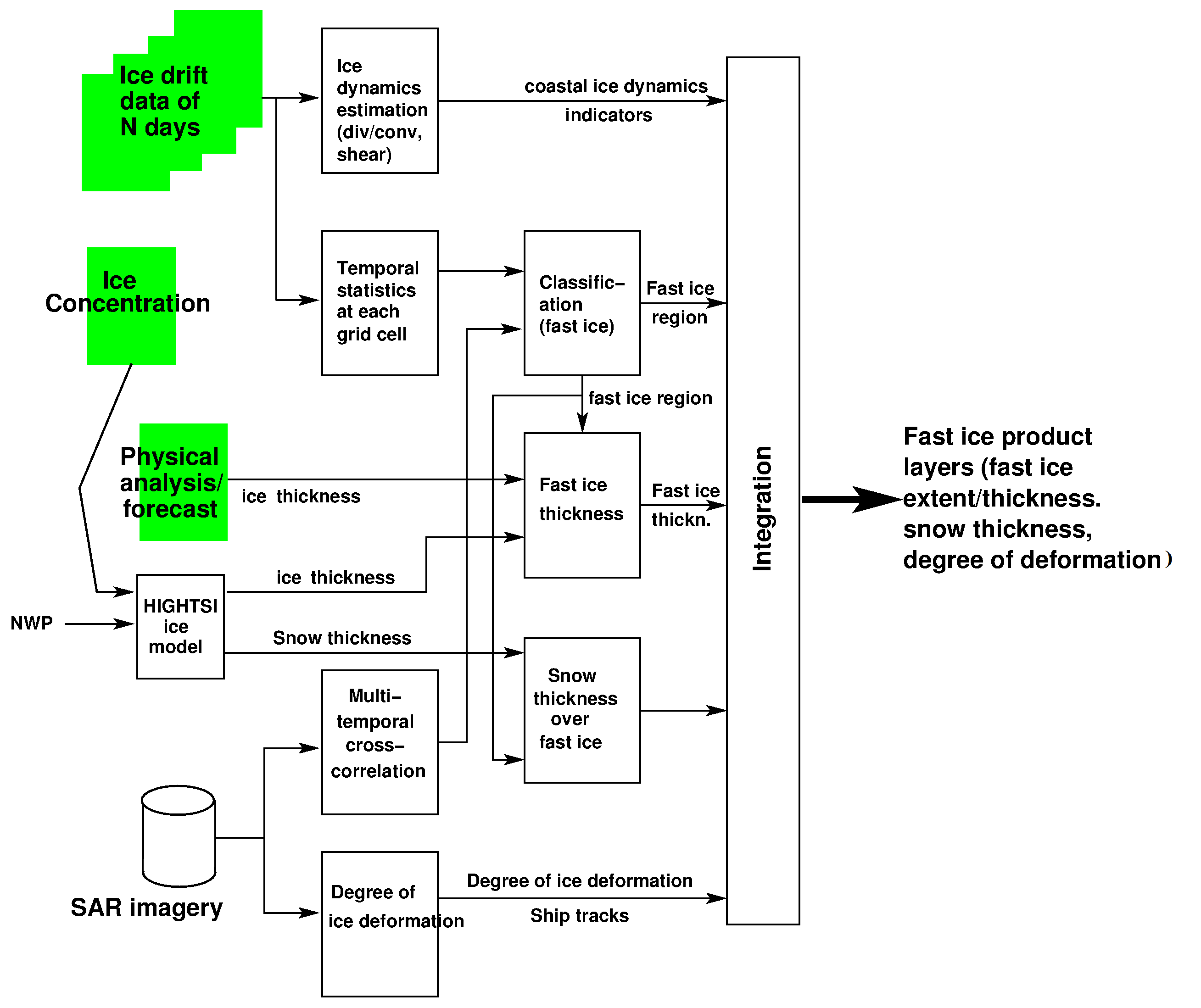
Schematic production chain of the BALFI Products.
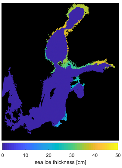
Example product – the Baltic Sea landfast ice extent and thickness on 15 March 2018.
Corpernicus Marine Service Products used in the BALFI service
BALFI uses data from the Copernicus Marine Service. Specific data sets used are:
- Baltic Sea Physics Analysis and Forecast
BALTICSEA_ANALYSIS_FORECAST_PHYS_003_006
- Baltic Sea - SAR Sea Ice Thickness and Drift
SEAICE_BAL_SEAICE_L4_NRT_OBSERVATIONS_011_011
- Baltic Sea - Sea Ice Concentration and Thickness Charts
SEAICE_BAL_SEAICE_L4_NRT_OBSERVATIONS_011_004
Integration of Corpernicus Marine Service information
BALFI integrates the information from three Copernicus Marine Service products listed above in the following ways (see also schematic production chain of the BALFI products):
Time series of the SAR based sea ice drift product together with temporal analysis of SAR imagery are used to estimate landfast ice extent (landfast ice is stationary).
Sea ice thickness data from two different sources: the Baltic Sea Physics Analysis and Forecast product, and HIGHTSI sea ice model run at FMI, are combined to estimates of landfast ice thickness and snow thickness on ice.
Sea ice concentration information from the ice charts is used as forcing data for the HIGHTSI model.
Generated using E.U. Copernicus Marine Service Information
 |
 |
|
| Landfast ice near Marjaniemi, Hailuoto island, on 7 March 2012. | Statistics on the Baltic Sea ice cover. |
BALFI service started on 10 Dec 2019.
Copernicus Marine Environment Monitoring Service: marine.copernicus.eu
FMI web-site: ilmatieteenlaitos.fi
Ice winter in the Baltic Sea: ilmatieteenlaitos.fi/ice-winter-in-the-baltic-sea
Ice conditions in the Baltic Sea: ilmatieteenlaitos.fi/ice-conditions
FMI satellite data centre: nsdc.fmi.fi
More information about the service: balfi@fmi.fi
More information about the Copernicus Marine Service: servicedesk.cmems@mercator-ocean.eu