Global monthly record for 1995-2017
Product name: FMI_SAT_AOD-MERGED
Product specification:
|
Variables: - AOD550 - AOD550_unc - Latitude - Longitude - Time |
Period: 1995-2017 Temporal resolution: month Spatial resolution: 1°x1° |
Data access: aod.nsdc.fmi.fi
Username: aod_user
Contact person:
Dr. Larisa Sogacheva (firstname.lastname(at)fmi.fi)
Overview:
Satellite instruments provide a vantage point for studying aerosol loading consistently over different regions of the world. However, the typical lifetime of a single satellite platform is on the order of 5-15 years; thus, for climate studies, the use of multiple satellite sensors should be considered.
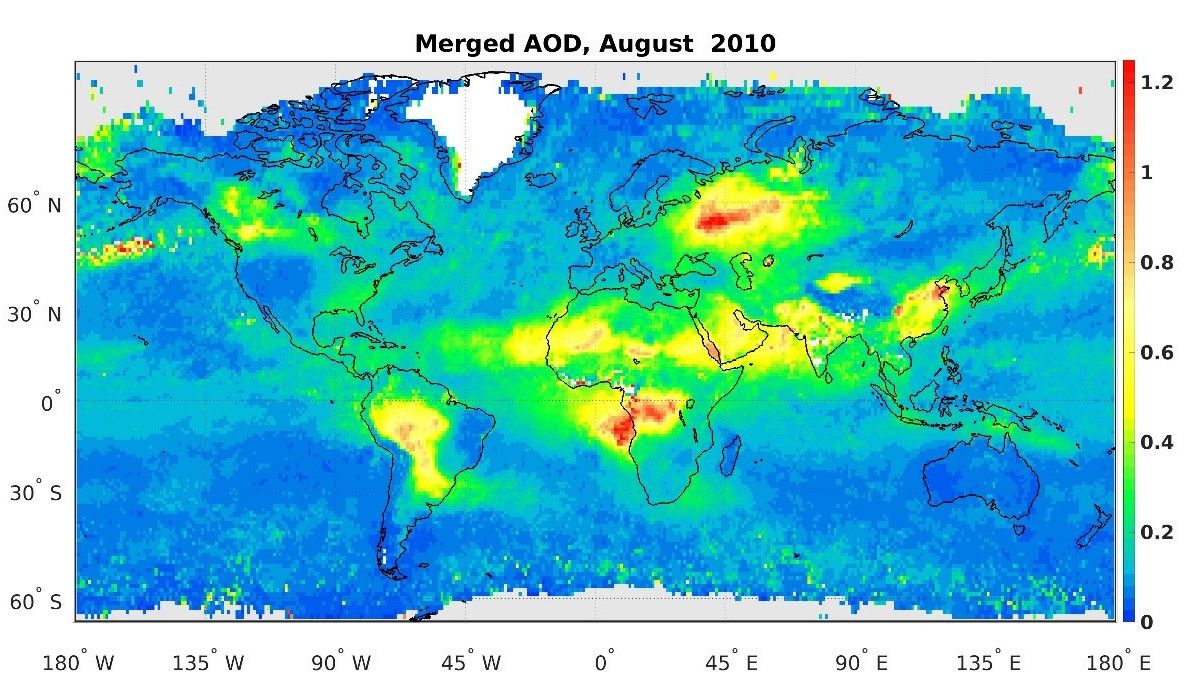
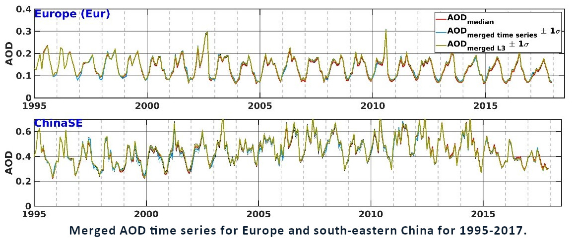
A 1°x1° gridded monthly AOD merged product for the period 1995-2017 was built from 12 individual satellite AOD products retrieved from AVHRR, SeaWiFS, (A)ATSR, MODIS Terra and Aqua, MISR, POLDER and VIIRS. Different merging approaches were applied; resulted AOD was evaluated with ground-based network of sun-photometers AERONET (aeronet.gsfc.nasa.gov). Optimal agreement of the AOD merged product with AERONET further demonstrates the advantage of merging multiple products. The quality of the merged product is as least as good as that of individual products. The temporal and special coverage of the merged product is better than one from the individual products. Thus, this merged dataset provides a long-term perspective on AOD changes over different regions of the world.
The records will be extended in the future as satellite missions continue and new data versions are released.
This study grew out of discussions at annual AeroSat (aerosat.org) meetings about how to move forward on the difficult topic of combining distinct aerosol data records. AeroSat is a grassroot community forum of several dozen algorithm developer teams and data users. Annual meetings in concert with its sibling AeroCom (group of aerosol modelers; aerocom.mpimet.mpg.de) allows active discussion between data providers and data users to highlight new developments and discuss current issues and open questions in the field of satellite aerosol remote sensing and aerosol modelling.
More detailed information can be found in the research paper below and the documentation provided at the above ftp-site.
When applying the data for commercial, educational or scientific works and publications, please use the following citation:
Sogacheva, L., Popp, T., Sayer, A. M., Dubovik, O., Garay, M. J., Heckel, A., Hsu, N. C., Jethva, H., Kahn, R. A., Kolmonen, P., Kosmale, M., de Leeuw, G., Levy, R. C., Litvinov, P., Lyapustin, A., North, P., Torres, O., and Arola, A.: Merging regional and global aerosol optical depth records from major available satellite products, Atmos. Chem. Phys., 20, 2031-2056,
doi.org/10.5194/acp-20-2031-2020, 2020.
acknowledge: Dr. L.Sogacheva and AEROSAT team (aerosat.org)
Tähteläntie 62
99600 SODANKYLÄ
tel. +358 29 539 2736
tel. +358 29 539 3005
© FMI 2016

